
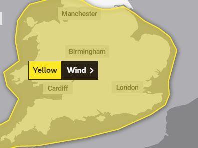
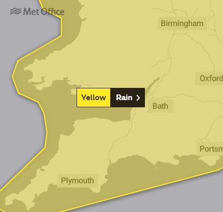
THE MET Office has issued a weather warning for heavy rain, thunderstorms and gale-force winds in the Cardigan area on Friday (August 9) and Saturday (August 10).
The yellow warning for rain from runs from 00.01 on Friday to midnight, when a band of heavy rain followed by heavy showers or thunderstorms has the potential to bring disruption.
There is a small chance that homes and businesses could be flooded, causing damage to some buildings
Spray and flooding could lead to difficult driving conditions and some road closures, with delays to public transport
A Met Office spokesman said: “A band of heavy rain, with the possibility of some very heavy bursts, will move northwards during Thursday night and Friday.
“Within this band 10-15 mm is widely expected, however some places could see as much as 30 mm in just a few hours. Once the rain has cleared scattered showers and thunderstorms are expected to develop, particularly during Friday.
“Many places will miss these, but where they do occur 10-20 mm is possible in one hour, with perhaps 30 mm in a few hours."
The following day, strong winds are expected to cause disruption, particularly during Saturday daytime.
It’s likely that some coastal routes, sea fronts and coastal communities will be affected by spray and/or large waves
Some short term loss of power and other services is possible, with delays to road, rail, air and ferry transport likely, with some fallen trees possible
The Met Office spokesman added: “Unseasonably strong south-westerly winds are expected to cause some disruption, with gusts over 40 mph possible quite widely inland. Gusts over 50 mph are possible along some coasts.”


Comments: Our rules
We want our comments to be a lively and valuable part of our community - a place where readers can debate and engage with the most important local issues. The ability to comment on our stories is a privilege, not a right, however, and that privilege may be withdrawn if it is abused or misused.
Please report any comments that break our rules.
Read the rules here